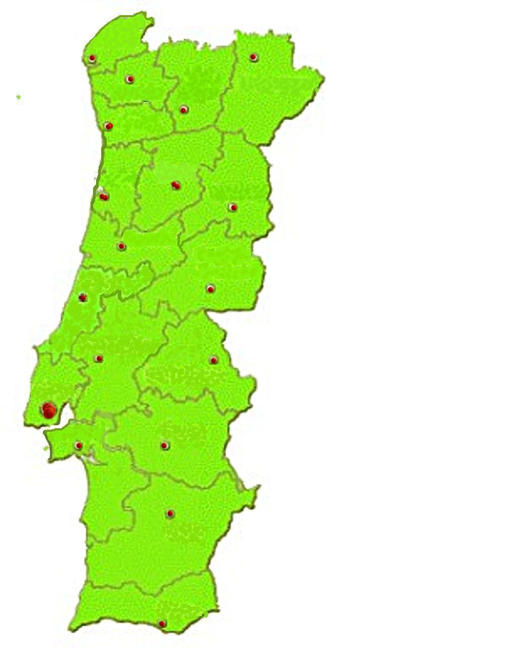
KARTE 18 Bezirke / Distritos PORTUGAL
download Karten Portugal:
http://www.igeo.pt/e-IGEO/egeo_downloads.htm
Maps Portugal - Karten für alle Regionen Portugals
http://62.48.147.230/mapa.html?lang=1
http://www.igeo.pt/gdr/index.php?princ=PROJECTOS/CLC2006&sessao=m_projectos#cartografia

|
NUTS II (Nomenclaturas de unidades territoriais para fins estatísticos em Portugal):
http://pt.wikipedia.org/wiki/NUTS_II
Região Norte
NUTS II (Nomenclaturas de unidades territoriais para fins estatísticos em Portugal)
Viana do Castelo
Braga
Porto
Vila Real
Bragança
und Teile von den Bezirken:
Aveiro
Viseu
Guarda
Gesamtfläche: 21 278 km² (24% der Gesamtfläche Portugals).
Bevölkerung (2007): 4 062 402 (37% der gEsamtbevölkerung).
Região Centro
NUTS II (Nomenclaturas de unidades territoriais para fins estatísticos em Portugal)
Coimbra
Castelo Branco
Leiria
und den größten Teil von
Aveiro
Viseu
Guarda
und begrenzt ca. ein Drittel vom Bezirk Santarem
Gesamtfläche der Regiao:28 405 km² (31% der Gesamtfläche Portugals).
Bevölkerungszahl (2007): 2 570 002 (25% der Gesamteinwohnerzahl von PT).
Região de Lisboa
NUTS II (Nomenclaturas de unidades territoriais para fins estatísticos em Portugal)
Besteht aus der Hälfte des Südens des Bezirkes Lisboa,
der Hälfte des Nordens des Distriktes Setubal,
Gesamtfläche der Regiao Lisboa :2802 km².
Bevölkerung (2007): 3 024 034 (25% der Gesamteinwohnerzahl).
Região do Alentejo
NUTS II (Nomenclaturas de unidades territoriais para fins estatísticos em Portugal)
Portalegre
Évora
Beja
und die Hälfte des Südens der Distrikte Von Setubal und Santarem
Gesamtfläche der Regiao : 31 152 km² (33% der Gesamtfläche Portugals).
Bevölkerung: (2007): 770 265 (8% der Gesamteinwohnerzahl)